

At JSM Group, a leading Utility Infrastructure Provider delivering integrated utility infrastructure solutions, our commitment to precision and innovation continues to shape the way we approach infrastructure planning and engineering services. One area where this is especially evident is in our use of bathymetric surveys, a technique that has evolved dramatically over time, transforming from rudimentary depth measurements to high-resolution underwater mapping. Nick Stillwell, a Pre-Construction Supervisor at JSM, explains how bathymetric surveys now play a critical role in supporting our utility infrastructure solutions and other engineering projects during the early planning stages.
How have bathymetric surveys evolved to support modern infrastructure planning?
Bathymetric surveying has a surprisingly ancient origin, dating back over 3,000 years to Ancient Egypt, where they relied on manual methods like lead lines and sounding poles, offering limited accuracy and coverage. Today, technologies such as Single Beam Sonar, GNSS, and Total Station workflows allow us to capture detailed spatial data with speed and precision. This evolution has unlocked new possibilities for infrastructure development, environmental monitoring, and flood risk management.
Why is bathymetric surveying critical for integrated land and water design?
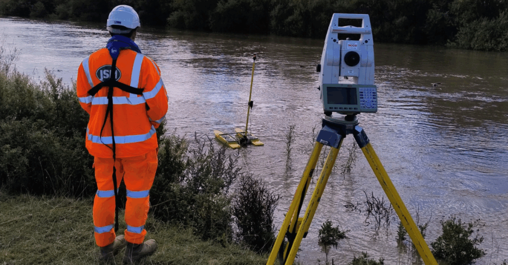
In a recent project, our team conducted a comprehensive bathymetric and topographic survey over two days, with a one-day turnaround on reporting. With the goal to support infrastructure planning with reliable, high-resolution data and by integrating underwater and land-based surveying techniques, we created a seamless model of the land-water interface which is critical for accurate volume calculations and design planning.
The resulting data provided planners, engineers, and stakeholders with the confidence to progress designs efficiently and reduce risk at later project stages.
What challenges do bathymetric surveys present on complex infrastructure projects?
Bathymetric surveying presents unique technical and environmental challenges. Factors such as water movement, visibility constraints, and restricted access require careful coordination, specialist training, and robust workflows.
However, through and robust workflows, JSM successfully delivered:
- Full 3D surface models
- Detailed CAD drawings
- GIS-ready datasets suitable for integration into wider utility infrastructure solutions and digital infrastructure contractor workflows
These outputs empower engineers and planners working across utility services and other engineering frameworks to move forward with clarity and confidence.
How are bathymetric surveys shaping the future of resilient infrastructure?
As infrastructure projects become more complex and climate resilience more urgent, bathymetric surveys are no longer niche, they are essential. They enable a deeper understanding of submerged environments, support risk assessment, and allow infrastructure to be designed with long-term resilience in mind.
At JSM, we’re proud to be at the forefront of this evolution, using cutting-edge survey technologies to support utility infrastructure experts, integrated utility infrastructure solutions, and full turnkey services across the UK and beyond. By combining innovation with engineering expertise, we continue to deliver insights that help shape the future of sustainable, resilient infrastructure.